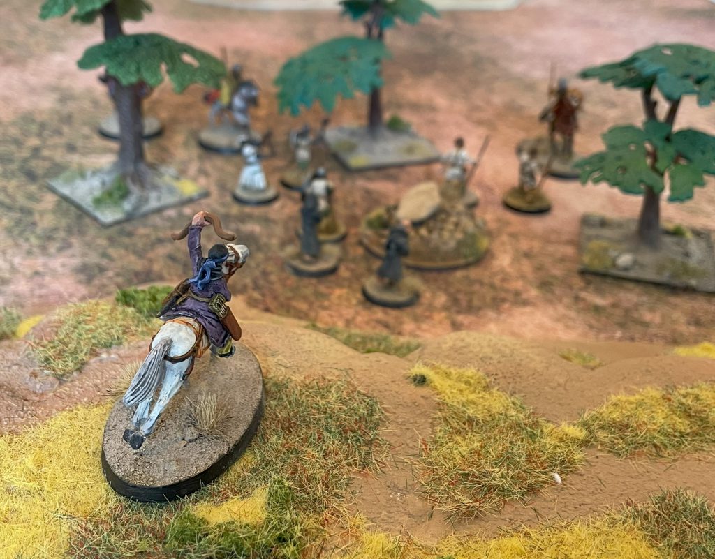
Last time in A Village in the East, I talked about making a board for Egypt-based historicals (and weird historicals). But I don’t really want to just make a set of terrain, a board, for gaming on. I want to build up a place: Nakam Iya’if.
Any “place” is an accumulation of the history and archaeology that came before the moment. When we walk around a town or city we walk past decades, centuries, even millennia of building and inhabitation, where decisions made in the past shape what came next. From my window I see a road built in the 1850s, resurfaced a dozen times or more but still dictating where houses and flats were built in each decade of the 20th and 21st centuries. The line runs parallel to an old Roman road laid down two millennia before just to the north, one that was used to map out the expansion of a growing industrial hub to the east of the old city. Two hundred meters down the hill, a church still stands on a Norman foundation, a thousand years of worship and burial since a newly appointed landlord marked his ownership with the founding of a new benefice. Long before both, this was just a slightly elevated area reaching across a marshland that ran from the river to the sea, fifty miles east. In archaeology, this kind of layered history is described as a palimpsest – a scroll that is written, wiped, reused again and again, histories overlaying histories.
We build boards to play games on that are supposed to be vaguely real. But the places we live aren’t just tossed down hills, trees and buildings arranged in an aesthetically pleasing and game-balancing way. They are recorded histories of human activity that can be read by those with the eyes to see them. There’s a reason that tree is there, that the 60s block of social housing is smack-bang in the middle of a Victorian terrace, even that there’s anyone in a particular place at all. Everything can be read, if not always understood. That’s what I want for this building project, the village of Nakam Iya’if, because that’s what makes it a place not just a board.
What’s the difference between a place and a board, between L-shaped ruins and real life? I think it’s the answer to questions – Why did people come here? Why is there a village here? Why is it worth fighting over for a thousand years? – that need to be answered with both mechanical considerations and deep, deep history.
The First Layer – Water and Valleys
The mechanical is the easy bit. Let’s take the only bits of completed terrain so far – two rocky hills – and the constraints of my tiny dining table. There’s only one way they can both work on the mat, and that’s having them on either flank of the board. That isn’t ideal and in games where “going up a hill” has some kind of effect, all we’re doing is funnelling the entire game into the central section. Luckily, neither Saga or Barons’ War cares much about hills beyond line of sight, so we might get away with it.
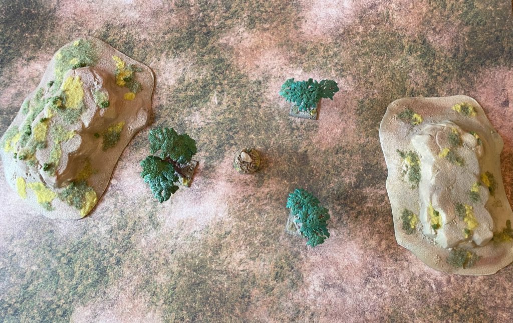
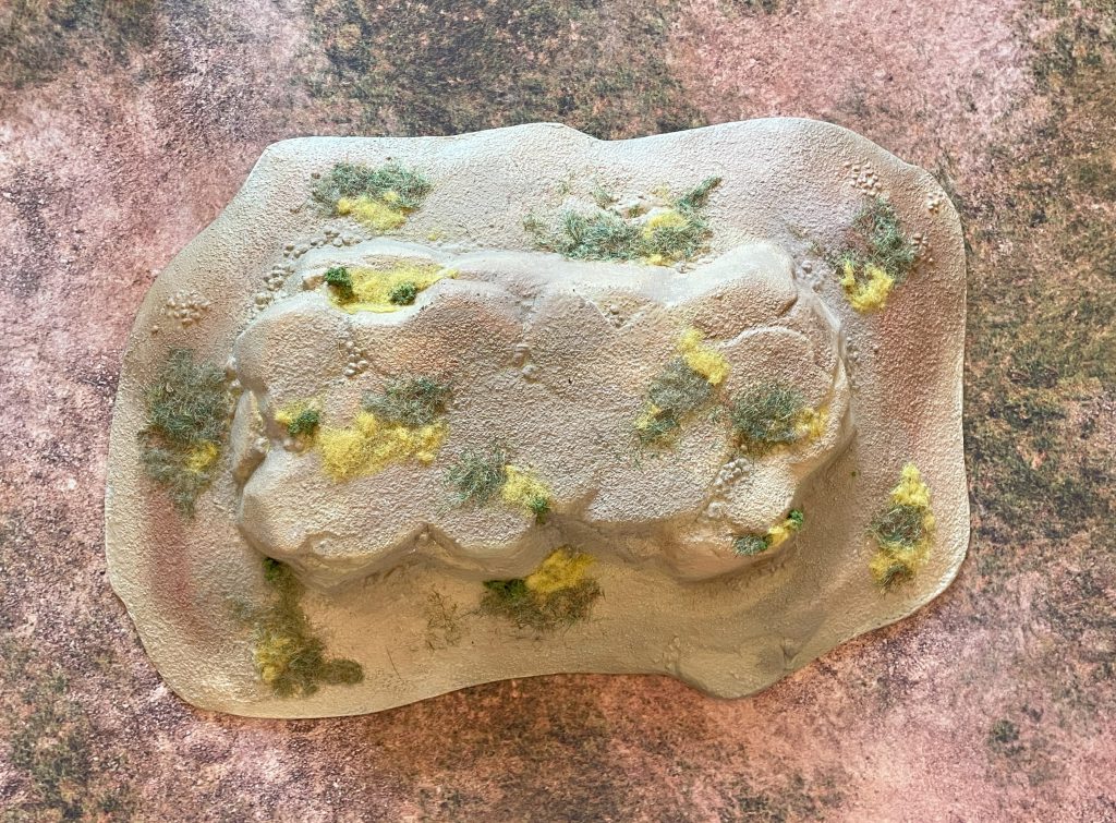
Why are these two hills here, with a valley between? At this scale, that suggests to me an old water course, somewhere water used to run between two outcrops. The area drains into the Mediterranean and was once much wetter than today, just over the northern edge of the great Saharan drainage basin, so a landscape dominated by the remains of water, areas that might even fill up again in exceptional conditions, makes a lot of sense. It also gives us a reason for humans to come and live between the hills. Water dictates virtually everything else, and the remains of larger waterways often have easier access to potable water, even if freestanding water isn’t present. We can see this by zooming in to modern day Matrough – there’s a dense network of semi-dry valleys that sketch out days of more plentiful water, still with farms and agriculture in them to tap into groundwater sources.
So we know why people may come here – because there was water, and it is still underground. We also have a trajectory of change through time, because extracting that underground water is a slowly sapping process. The denser the inhabitation of the area the more arid it will become. Depending on the crops grown in any one period, we can accelerate or slow that process.
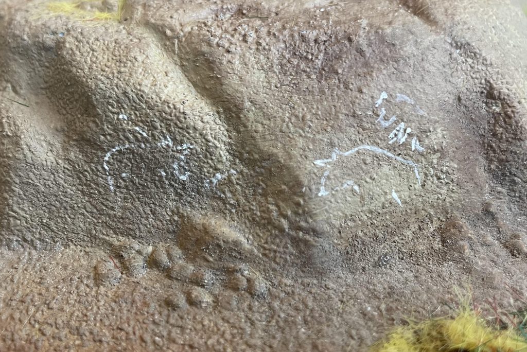
If I was playing a miniatures game set in the Mesolithic or early Neolithic, we might well stop there. There’s a valley, and some people are roaming across it. The traces they leave are ephemeral, not large or persistent enough to mark out in 28mm scale. Where they might leave a mark is in Saharan rock art, a long and enduring tradition of Saharan pastoralists, hunters and early farmers creating fantastic art either painted or carved into their landscape. To add that first human layer to the palimpsest, I’ve drawn some approximations of the Qurta Petroglyphs onto the hills – a mark of 20,000 years of detectable human occupation.
Pre-Historicals but Not Prehistory
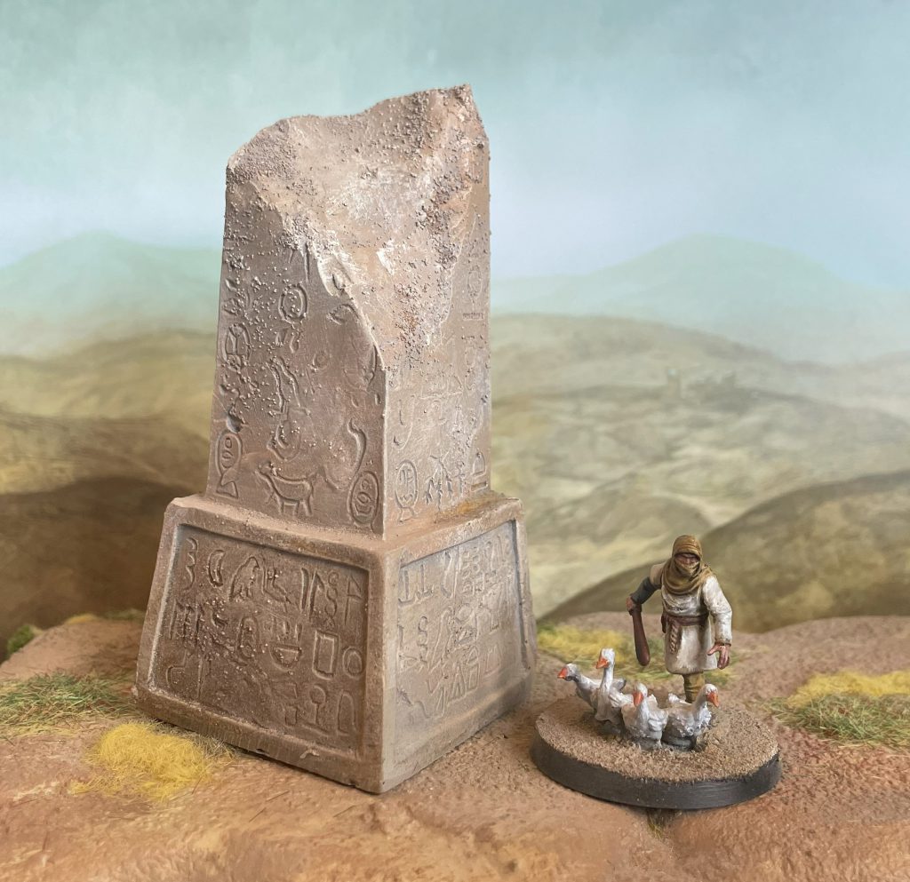
The earliest phases of human habitation in the area that will become Nakam Iya’if won’t leave traces that will persist to the first era I’m going to model (the 11th century). The Egyptian Neolithic may return in scatter terrain for a Silver Bayonet and Napoleonics board (watch this space), but out on the westernmost fringe of the Nile Delta, the first major construction in our area is going to be marking a conflict in the area between the New Kingdom and Libyan tribes. After Pharoah Merneptah won the battle of Perire (about 1208BC), we’re going to say that he needed a powerful warning to the tribes over the “border”. Our village is out beyond the intensively farmed delta, perhaps at the very limits of the riverine power of the early Egyptian dynasties, so let’s commemorate that by raising a marker on the borders of the Empire, perhaps sited on a convenient hill:
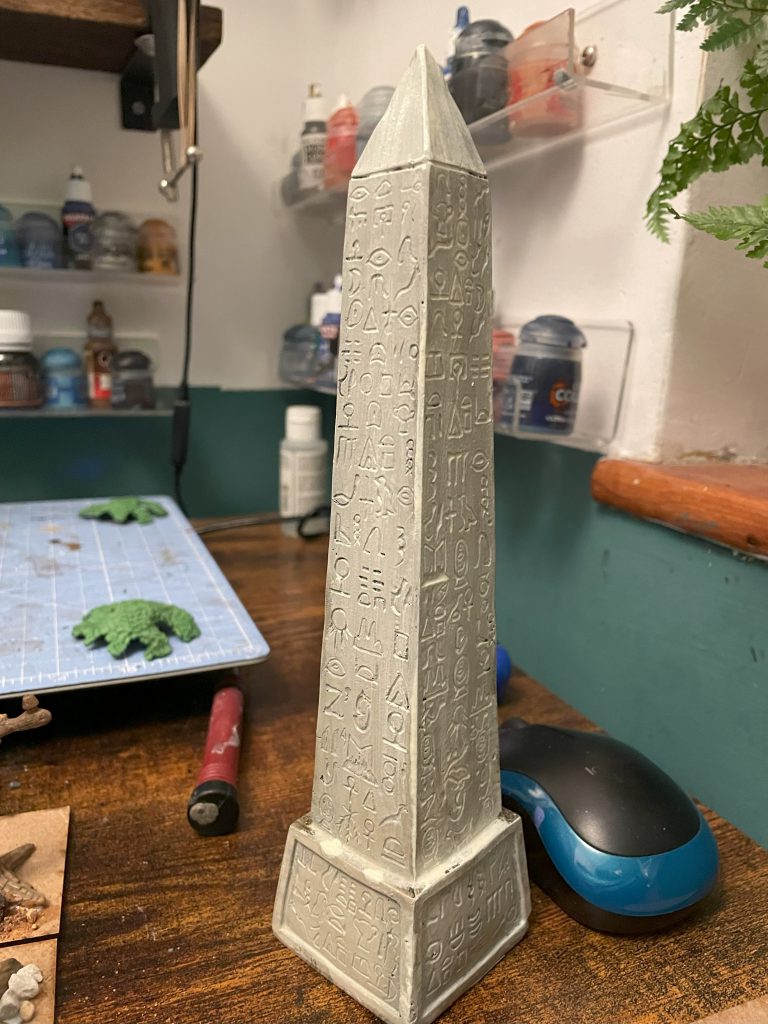
It’s tacky, it’s huge, it’s utterly tasteless, but it serves as a warning to any bandits coming over from what will be Libya – any further and you’re in territory protected by armies and powerful gods. The obelisk is a very cheap and surprisingly massive bit of fishtank decoration, which I’ve repainted, weathered, obscured the fake heiroglyphs, and beaten up – by the time of our next skip forward, it’ll be 4,000 years old! The obelisk is rooted in place – it will always be here, unless someone in blue or red digs it up and moves it to London or Paris (spoiler alert there).
I then thought it was too big and hit it with a hammer.
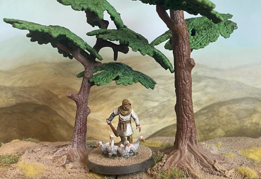
We need more of a reason for why people will eventually come to the valley to live other than “there’s a big phallic monument there”, so we’ll turn to our trees. These are very, very cheap plastic trees fished out of a children’s playset (and then I bought more on Temu), but they’re robust and scale well enough that I want to get a few more rather than deal with finicky fronds that will be destroyed over time in the storage box. Without people to spread them, these trees have to be native (and not domesticated) to the area while still giving a good reason why they tie residents to the valley. There’s only one tree that springs to mind – the North African Acacia (Acacia nilotica), a thorny tree that produces gum arabic, seedpods with beneficial properties for cattle and other grazing animals, lumber and medicinal bark.
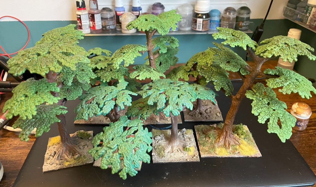
Painting these trees up as acacias is simple – a very classic light and dark mottle for leaves, trunk and branch a rich brown with occasional grey. As we go through time the Acacias can and will move around as individual trees die and new ones grow, a handy excuse for breaking up the flow of the table between game periods and giving me a good reason to base them in ones and twos.
Trade and Roads
We know that people came here in the New Kingdom Period of Egypt. We have reasons for them to come – relatively accessible water, acacias for all sorts of purposes – but we can finish off today by thinking about how they get there, and why they stay. Before we settle Nakam Iya’if with houses, the inhabitants are still mobile, coming to this small valley for a specific purpose. We can give them it with a well – a stopping place on the long road between Lower Egypt and Libya, or merely a good place to come when you’re grazing your cattle. Perhaps the well is dug out towards the end of the New Kingdom period, when raiding (and Sea People!) from Libya began to accelerate the decline of Ancient Egypt as-was.
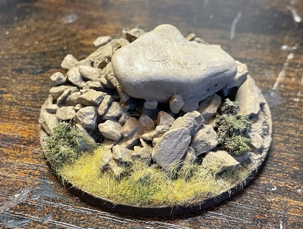
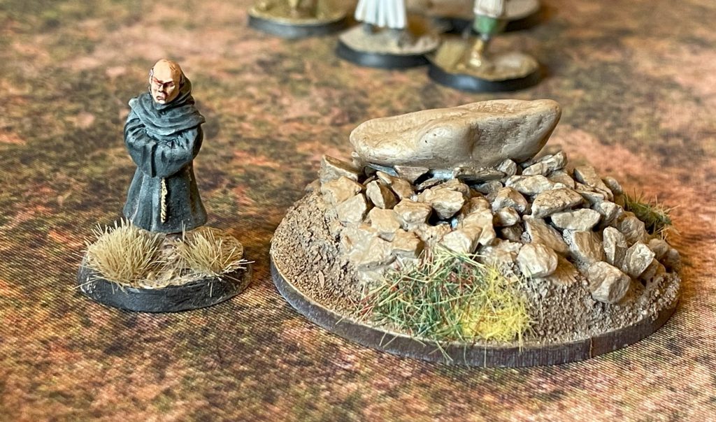
The well is a simple job, a round base built up with a little tinfoil, covered in sand and with a mound of rocks over it. I’ve seen many of these in semi-arid areas, where tipping off the top rocks allows you access to either a shallow pool or a deep well. It’s enough for us to say that this well isn’t about providing water for agriculture or huge numbers of people, just enough for, perhaps, a herd of cattle or goats as they move through the area. It’s enough to make you stay in this place for a time – a seed from which a village grows.
We could build a road, but this isn’t a used enough landscape – yet – to keep a permanent track visible in semi-arid brushland. For now, we can orient the board as a track, with the wider valley mouth to the north, those wandering up taking any route they want between the hills.
With only a few pieces finished, there’s a narrative and a setting to this board already. It isn’t a random collection of bits of terrain, but a place that could exist, with a structure that guides how people will interact with it. Naqam Iya’If isn’t inhabited, yet, but it isn’t empty either. With the setup complete, next time we’ll put our first buildings down and talk about who lives here on the edge of the Western Desert.
Tracking:
Terrain finished: 10
Terrain Bought: Tacky Obelisk, more crap trees
Donation to MSF (cumulative): £46
Have any questions or feedback? Drop us a note in the comments below or email us at contact@goonhammer.com. Want articles like this linked in your inbox every Monday morning? Sign up for our newsletter. And don’t forget that you can support us on Patreon for backer rewards like early video content, Administratum access, an ad-free experience on our website and more.