The space between writing these articles is made of two parts:
Cramming as much reading in as possible on a given period before my brain leaks
Furiously attempting to synthesise all that reading into modelling.
For the last month, I’ve done far, far too much of the former. Last time I thought I’d done enough to start gaming with the village of Nakam Iya’If in the eleventh century, with the early, lost and bewildered crusader fleets travelling along the North African coast. Given where I stopped, though – at some point in the New Kingdom of Ancient Egypt – there was a lot of history left to read.
This article is part of a series:
Relevant History?
I’m not going to model every last bit of that history, though it has been interesting. The Matrouh governorate kept growing and expanding in importance as I went, but the fringe villages of the major conurbations didn’t. This simplifies our next layer – after water, land and trees comes people. It’s possible to keep our village as a small farmstead, scattered buildings around a well, supporting goats and light farming from the time of Rameses II to Alexander, Cleopatra and beyond – all the way through to Islamification and the Crusades. Clothing, language, culture will all change in this time, but the form of buildings will stay close enough in these rural contexts that (thankfully) I don’t have to buy a new building every time we move forward a century.
I’ve decided on three buildings – two complete and one ruined – that will form the heart of a small accumulation of settled agriculturalists (loath to use the word “peasants” here because they’ll represent the homes of a very wide base of people!) who do a little storing and trading. They’re the ones who – just about – control access to the well. Not a large settlement, perhaps a single extended family. The buildings are generic “north african/middle eastern” buildings from a variety of manufacturers.
All were painted in the same way, gradients working from black through three shades of brown to bone and white as you travel up the walls. This is both very simple to paint and represents widespread treatments of mud brick buildings in north Africa. These are working buildings in a dusty, dirty environment – animal herding generates a huge amount of shit, and the animals are held close to the buildings!

My one concession to the eras I’m skipping is to include their distinctive rubbish in my scatter – a few roman-red clay pieces in my rubble. Everywhere you get Romans, you get red pottery.
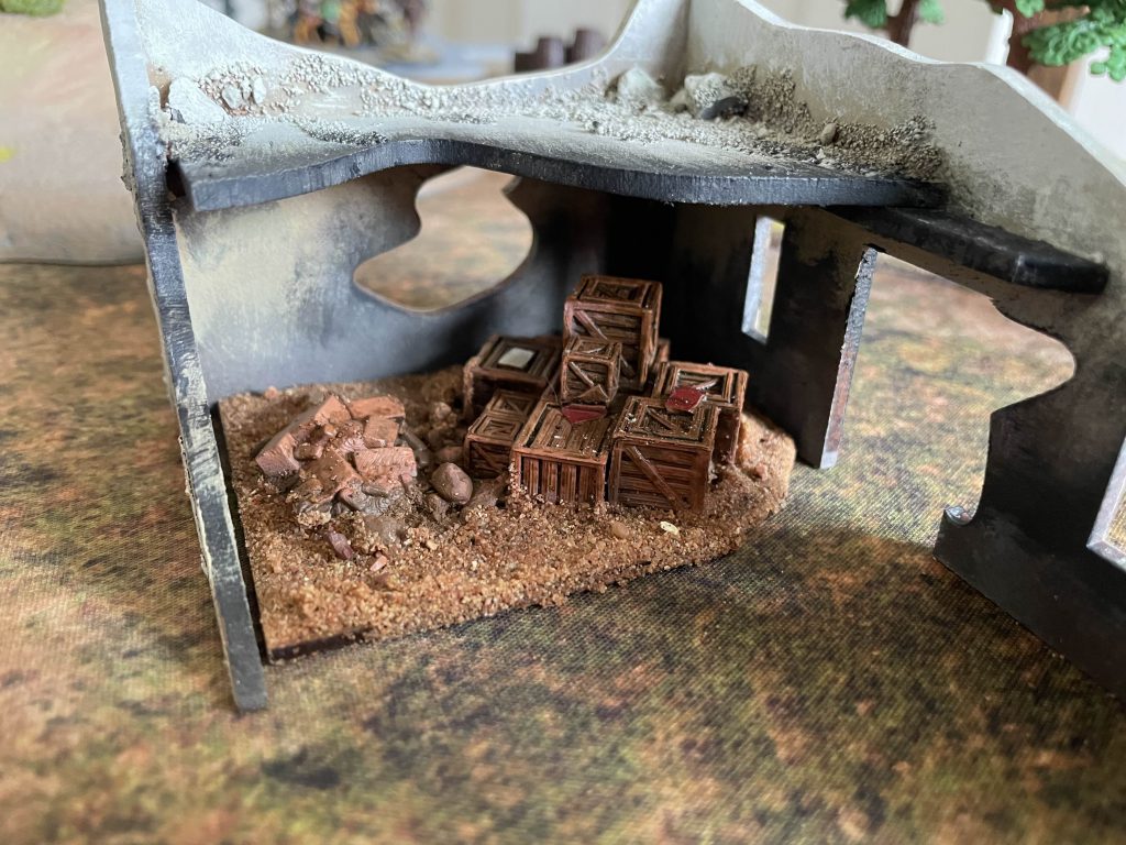
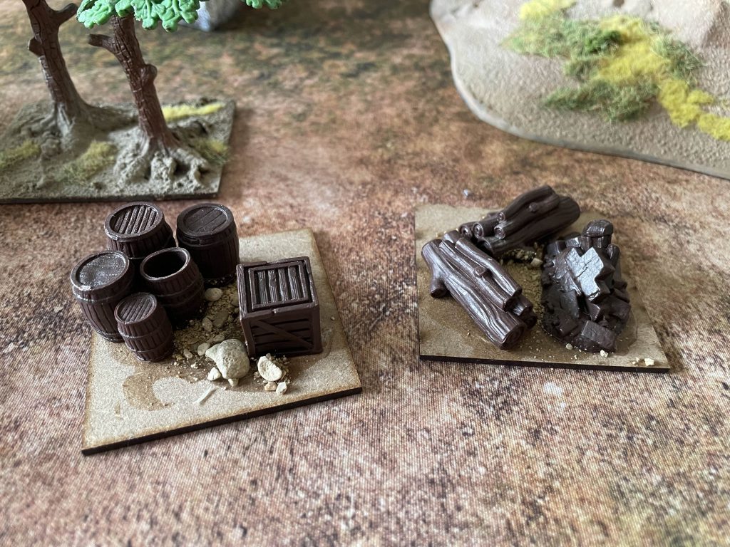
Whatever is happening in the area, this is the form our village will be in when the crusaders arrive. Buildings can (and will) move being replaced by ruins and rebuilt elsewhere, but the basic form of a few small buildings will endure for a long time. In the rush to get this article in before I went on holiday (I’m probably off in Europe when you read this), I didn’t get my last pieces painted, but some wood, brick and crate scatter from the Mantic Dungeon set makes for a nice bit of texture. These are based on the same squares as my trees, so they can slot under (or into buildings) easily.
Matrouh Through History
The surrounding area – today’s Matrouh Governate – got bloody interesting as I read. Our village is – accidentally – just off a major trade route along the North African coast, one that became, and stayed, important from the Late Period of Ancient Egypt (circa 700BC) all the way through to the Islamic conquests in the 7th century AD. That’s an astonishingly large amount of time to be by a major trading route, and, with the expansion and establishment of cult and trading centres to the north and south, the point where I’d envisioned the village is just a couple of miles off what may well have been a vital crossroads.
Mersa Matruh, the nearest major urban centre, expanded to be a major part of Rome’s extractive economy, shipping Egyptian grain across the Mediterranean to provide the most vital element of the bread and circuses. It was a wealthy trading centre, with a wide network of villages and farms feeding the grain trade. It was the first port for seaborne travellers from the west, pulling in shipping from across the Mediterranean to supply all of Alexandrian, Ptolomaic and Roman Egypt west of Alexandria. It retained its importance under the Byzantine empire, transferring the all important job of keeping Rome fed to second Rome. Throughout all this time, farms like ours would have been suborned to the many and varied demands of this urban centre, as well as receiving new populations, traders and visitors as shifting patterns of migration changed across the Mediterranean. It’s an area that could reasonably have been resettled by Roman veterans, been bought up by trading magnates, got involved in the religious tourist trade to Egyptian, Roman and Hellenic cult centres – there’s a huge range of possibilities!
Finding a lot of this information has been hard, and finding details of the archaeology of rural western Egyptian life at the turn of the millennium has been even harder. If you know of good sources, please let me know – I’d love to know more. In the end while this won’t all matter for the board, it gives me a good idea for expansion – our village is the end of the line, but what if we moved downstream a little? What if this is Old Nakam, the farm that led to a hamlet, a village? What if, just a couple of miles down a dusty path is the trading town of Nakam, poised to reap the benefits of trade routes stretching from Alexandria to Hispania?
The farm, to an extent, is largely done. A few more bits of rubble scatter and we have an excellent looking board that could run as a rural setting from the Crusades through to the Second World War already. More era-themed scatter will come, but I’m already hitting the limits of what I can do with the space available. A second setup – a whole damn town – is clearly on the horizon.
A Roman Holiday
It’s been an enjoyable process thinking all this through, though the results have been quite simple – a small farmstead of several buildings, some scatter terrain and as yet unfinished animal based objective markers. However simple the results, the board has been given an element of additional realism to it, and the first historical snapshot, the set board for a particular time period, can be made here.
Ptolomaic/Roman Era
Nakam Iya’if is an out-of-the-way farmstead in the valleys southwest of Paraetonium, one of a hundred farms serving the rural areas around Rome’s great grain port. It lies just off the great crossroad from Paraetonium to Ammonium and Alexandria to Libya, though travellers off the via are largely unaware of the farm’s existence beyond a year-round well. Three centuries of building and rebuilding in sun-baked brick have concentrated farm buildings close to the well.
While centuries of Greek influence have had little impact here, the rapid expansion of Paraetonium has drawn the valley into a new trading network. A ready market for travellers leaving the roads for water has started to bring new faces to the farm. The faint memory, handed down for generations, of the Pharaoh Aleksindres passing this way to be anointed by the Oracle of Siwa is proudly spoken of, but you can say the same for every farm in the valley.
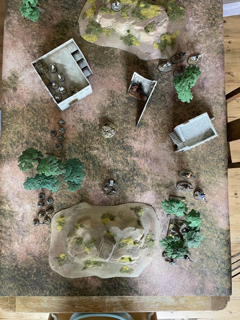
Terrain:
Farmhouses (x2)
Trees
Hills (x2)
Well
Scatter – Farming and rubble
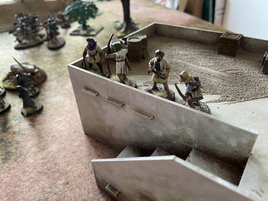
While I’m not going to commit to loads of games in this kind of Hellenic/Roman period, just in case I do I have made (but not painted!) two villager objective markers that should fit right in:
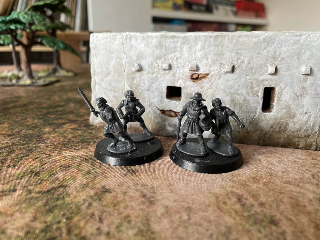
These are pretty simple, almost entirely made up of the Gangs of Rome kit from Wargames Atlantic, but add a bit of first century AD flavour to the board. Sometimes, fashions in clothing change a lot quicker than in buildings – though if I do play more in this time period, I’ll have to include some more roman themed terrain!
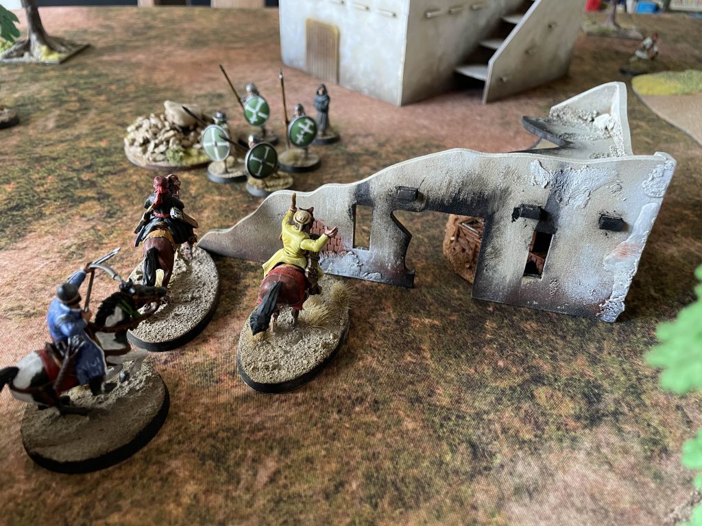
The First Game
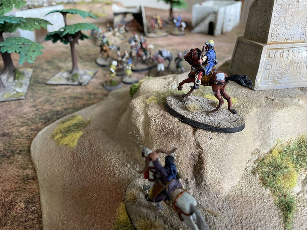
Next time I want to skip ahead to look – briefly – at Islamification and the Islamic conquest of the area, hopefully taking a look at what this might add to the farm, and begin planning the nearby town. Before doing any of the research though, I wanted to play on the board, so I dug out every non-Islamic villager I have, a couple of Islamic cavalry and played the first wave of skirmishes between the Byzantines and the Rashiduns using the Barons’ War.
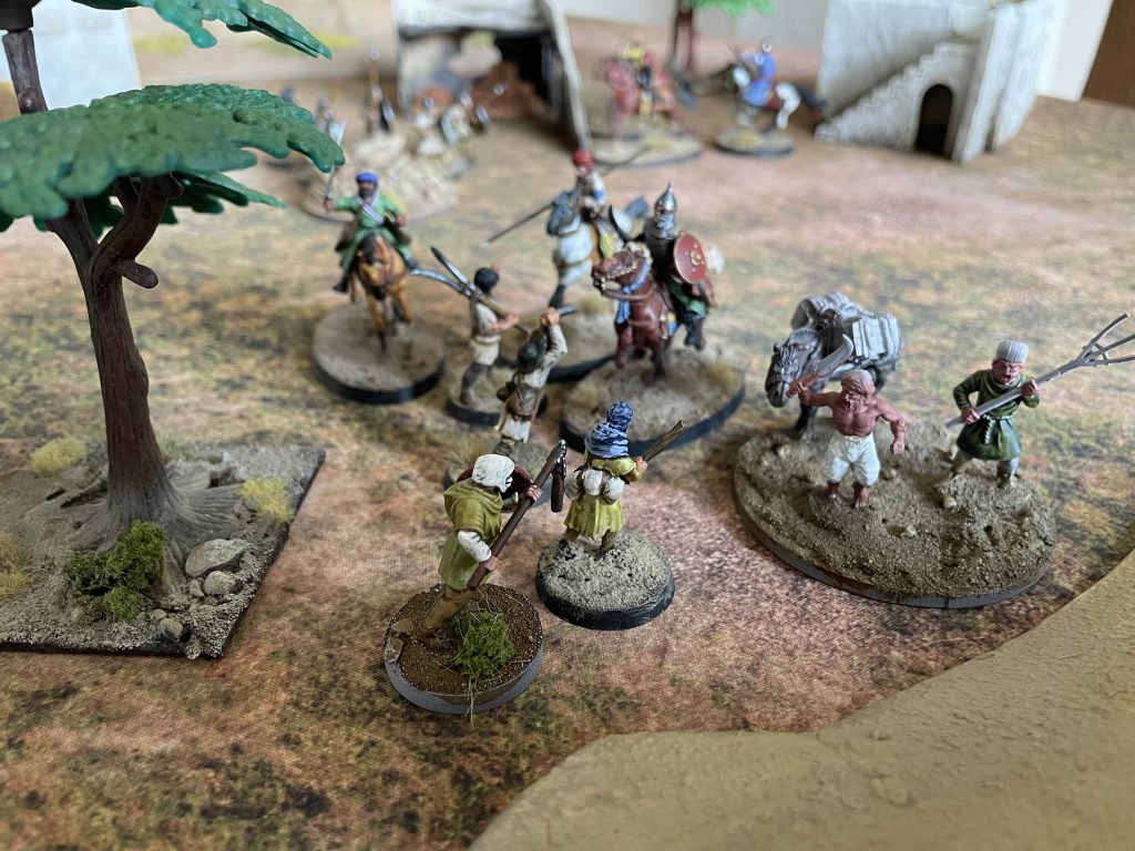
This was a real “hey come round and roll dice for 30 minutes” game, using four objectives to represent key resources – water, trade, animals – and the objective of “hold as many as you can when real life intervenes and we have to stop”, which I think always makes for a good game. When you’ve no idea when the game will end, you make risky decisions!
While the Byzantines put up a good fight, with the last legion veterans (this is 7th century, so the legion system is within living memory!) managing to hold on to the central objective, Islamic horsemen ruled the day, slowly picking off men one by one as some unwisely deployed ranged levy watched over the goose objective and were functionally ignored the entire game! We ended with 3 objectives in the hands of the Rashidun and one with the Byzantines. The conquest is unstoppable, and here at least, there was no truce or quarter given!
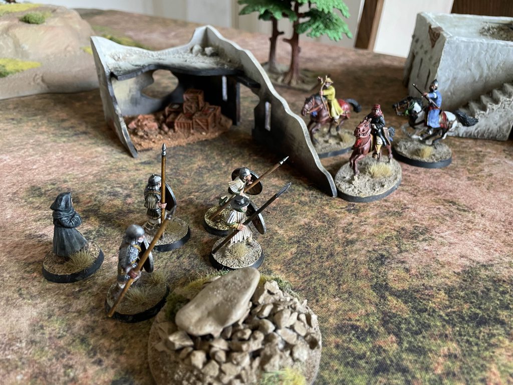
The result of the battle is to watch history unfold as it did – after a little resistance, the Rashiduns take the valley, and the rest of Egypt with it.
Tracking
Terrain finished: 5
Terrain Bought: Houses
Donation to MSF (cumulative): 81 (I’m going to bankrupt myself doing this)
Have any questions or feedback? Drop us a note in the comments below or email us at contact@goonhammer.com. Want articles like this linked in your inbox every Monday morning? Sign up for our newsletter. And don’t forget that you can support us on Patreon for backer rewards like early video content, Administratum access, an ad-free experience on our website and more.